UC Experts Create Map of Avian Flu Spread
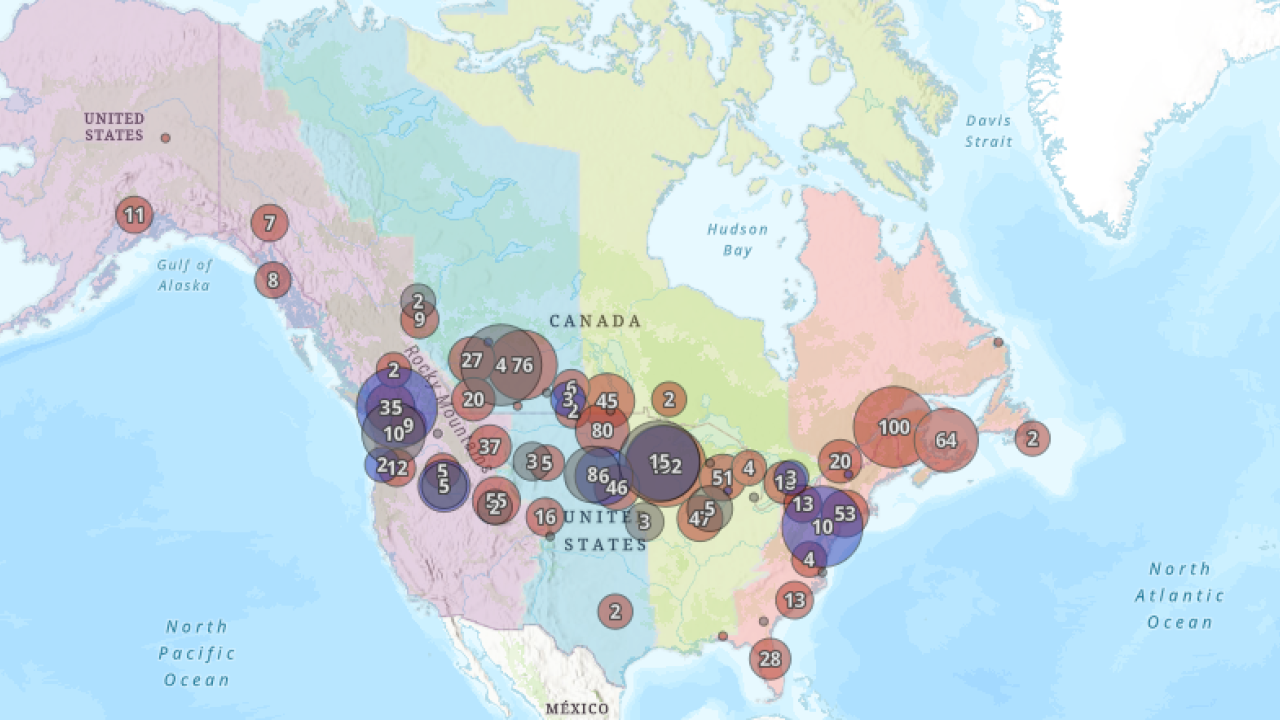
A poultry expert at the UC Davis School of Veterinary Medicine (SVM) has teamed up with a geographic information systems (GIS) expert at UC Agriculture and Natural Resources (ANR) and two wildlife health experts from the UC Davis SVM Wildlife Health Center (WHC) to create a map showing the spread of highly pathogenic avian influenza (HPAI) since 2021.
The map, created by Dr. Maurice Pitesky (SVM), Shane Feirer (ANR), Dr. Marcela Uhart (WHC), and Dr. Ralph Vanstreels (WHC) (along with Jeff Buler, PhD, from the University of Delaware), shows the specific types and numbers of HPAI infections throughout North and South America from November 2021 to March 2024. Its comprehensive view of the outbreak can be used by farmers, state departments of agriculture, the USDA, and academics to better understand how HPAI spreads between wild waterfowl (the primary reservoir) and domestic animals including poultry and livestock. For example, one can see how Canada’s surveillance system worked as a method to warn the U.S. when HPAI first came to North America. Likewise, the U.S. surveillance system identified waterfowl detection in the Carolinas before detections in commercial poultry. This type of surveillance is critical toward creating a robust integrated international surveillance system which helps farmers, responders, and researchers at a regional and hyper-local level.
Experts at the UC Davis School of Veterinary Medicine have been researching HPAI for many years and have been closely following the latest outbreak.
Pitesky, an associate professor in cooperative extension, focuses his research on HPAI disease modeling. He examines how the disease moves from wild waterfowl, such as ducks and geese, to domestic poultry. He is also focused on the economic, environmental, and animal welfare impact of HPAI.
Feirer, a GIS manager, focuses his activities and research on the use of spatial technologies to extend UC research to the universities’ constituents (the public). Some areas of GIS expertise include wild birds, water, conservation, wildlife, weather, and natural resources.
Uhart, director of the Latin America Program, is a leading expert on HPAI outbreaks in South America. She leads the program from Argentina, where her research focuses on free-ranging wildlife health and conservation, especially in marine wildlife (particularly mammals and birds).
Vanstreels, project scientist of the Latin America Program, conducts research and conservation projects across the Southern Hemisphere, especially in Argentina, Brazil, and South Africa. His work focuses on the ecology and pathology of wildlife diseases and their implications for conservation, with an emphasis on penguins and other seabirds.
An outbreak of HPAI has been spreading throughout the United States and beyond, affecting poultry production and other livestock industries. This highly transmissible strain of bird flu has resulted in the deaths of millions of chickens and turkeys and has recently been detected in cattle in the central U.S. and marine mammals in South America. In a few rare instances, the flu strain has also been transferred to cats and humans.
Details of the map:
Note I: The North American data includes both domestic and wildlife detections, while the South American data only represents wildlife. In addition, data for wildlife in South America may be inconsistent across countries due to differences in surveillance strategies and to some countries discontinuing their reports of confirmed HPAI H5N1 cases to the World Animal Health Information System/World Organization for Animal Health since late 2023.
Note II: To view the outbreak as a dynamic video, click the play button on the bottom right. To see the legend, click on the map layers in the top right. These layers can be turned on and off to better visualize specific data by clicking on the "eye" to the right of each item on the legend. The map can also be zoomed in or out. The numbers represent the number of accessions for each location and do not represent the number of dead birds.
Questions or comments on the map can be directed to Pitesky at mepitesky@ucdavis.edu.
# # #
